Before the internet, classrooms often had a set of encyclopedias. One of my fifth grade classmates decided he would read all 15 volumes of the Britannica Jr. that our room had. He started at the end. Not only did the last volume cover subjects that began with "WXYZ," but it also contained an atlas. He started looking at maps and never got any further.
I was reminded of how interesting he found maps, when I read about a new book, Mapping It Out. One of the maps included in this book is a map of Africa that I used to hang in my classroom. To illustrate the size of Africa, this map fits China, the United States, Europe, India, and Japan inside the continent. This kind of presentation is very useful, since transferring a global world to a flat page distorts the size of countries north and south of the equator (See the earlier post, "You Are Here.").
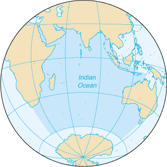
Having an Atlas, or a shower curtain with a map printed on it, is especially helpful when countries, islands, cities, mountains, and bodies of water are in the news. Hearing that Narendra Modi from the Bharatiya Janata Party (BJP) became India's Prime Minister sent me to an Atlas, when I heard he was born in Ahmedabad, a coastal city in the western Indian state of Gujarat, south of Pakistan. As host to some World Cup soccer games in 2014, the city of Recife shifted our focus from the Amazon in the west to Brazil's eastern tip on the Atlantic Ocean. When hearing that Stephen Hung ordered $20 million dollars worth of Rolls Royces (30 cars) to transport visitors staying at his Louis XIII resort in Macau, the question arose: Where is Macau? Unfortunately, invasions, such as Russia's into Ukraine, and disasters, such as the downing of Malaysian Flight MH17 and the disappearance of Malaysian Flight 370 and the finding of its wreckage on the island of Reunion (See the earlier post, "Who Needs International Expertise?"), cause us to visit the border of Ukraine and Russia and to contemplate the vastness of the Indian Ocean.
Children can look at maps to pick out shapes (See the earlier post, "How the World Shapes Up."), to find where people practice different religions (See the earlier post, "Respect the Faith."), to have an international scavenger hunt (See the earlier post, "Games Children Play."), and to study currents, mountain elevations, count time zones, and plan where they want to visit and work (See the earlier posts, "See the World" and "What Do You Want to Be?"). Also, check out Maps4Kids.com, which has a wide variety of activities associated with maps.